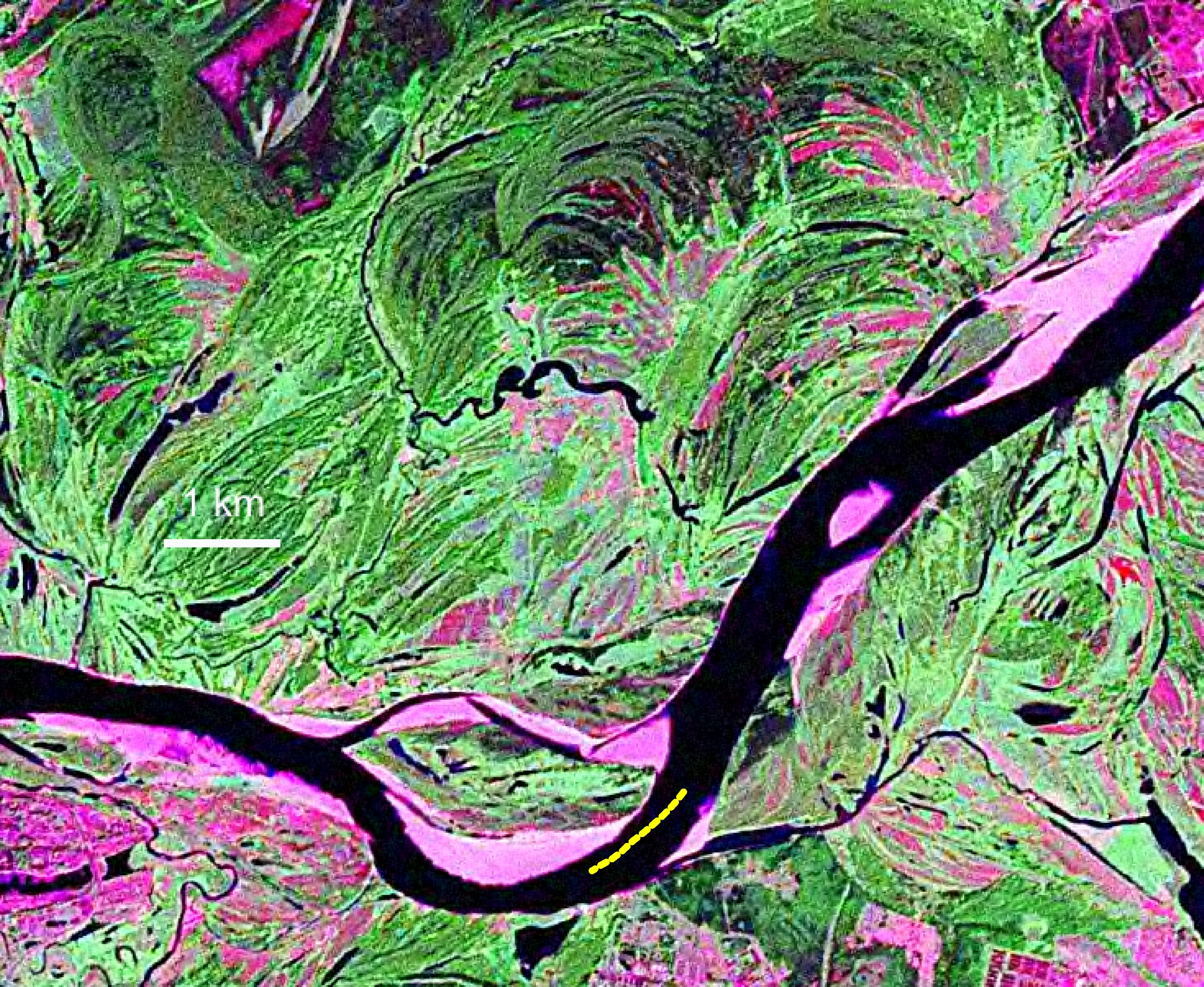
- Space image of the Vychegda
River between Kotlas and Solvychegodsk with the Sheshurovskiy shoal JPG
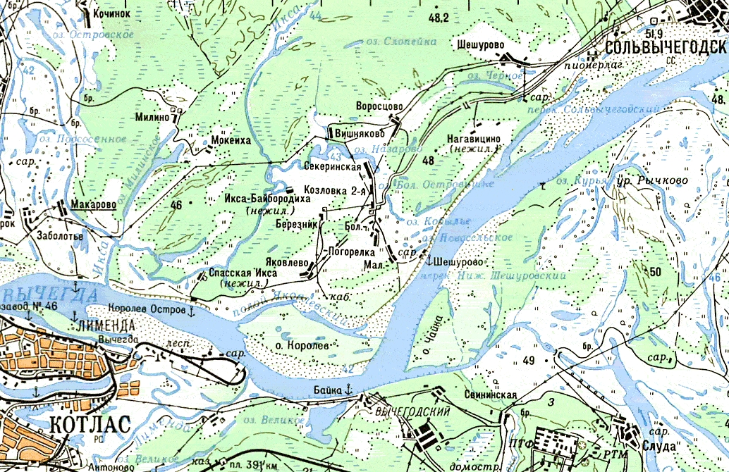
- The map of the Vychegda
River between Kotlas and Solvychegodsk with the Sheshurovskiy shoal JPG
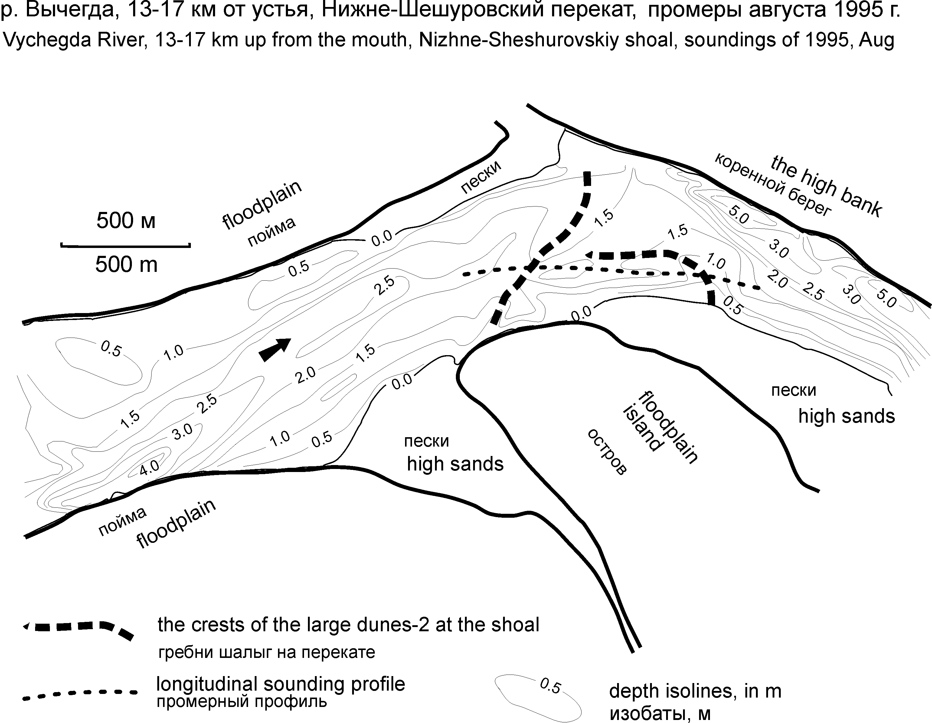
- The map with the
soundings of the Sheshurovskiy shoal JPG
- Water levels (cm above
station zero mark), Fedyakovo station, the Vychegda River, 1997 PDF
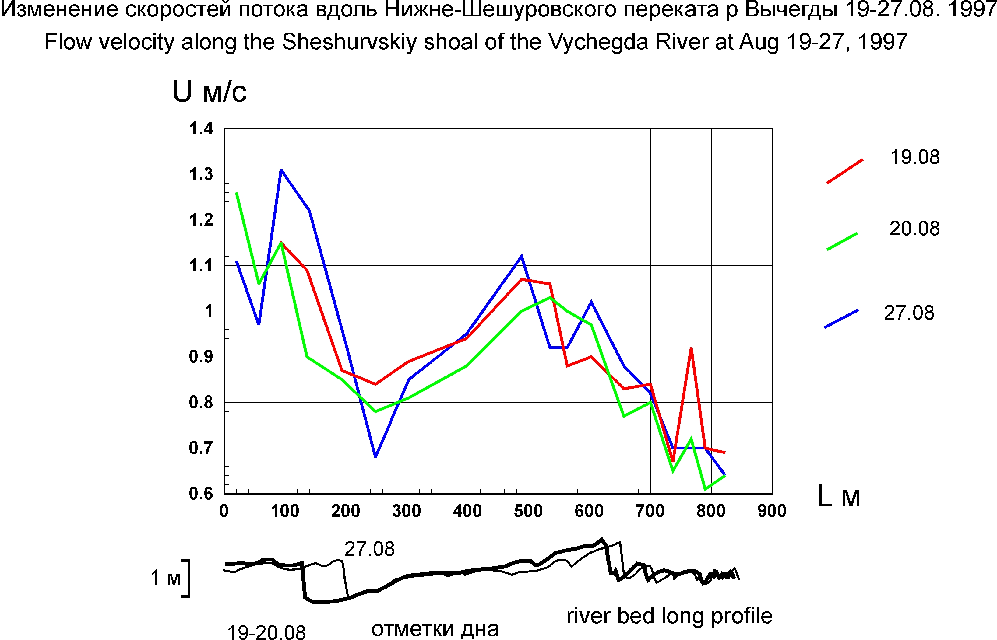
- Flow velocity
distribution at the Sheshurovskiy shoal (table) PDF
- Flow velocity
distribution at the Sheshurovskiy shoal (figure) JPG
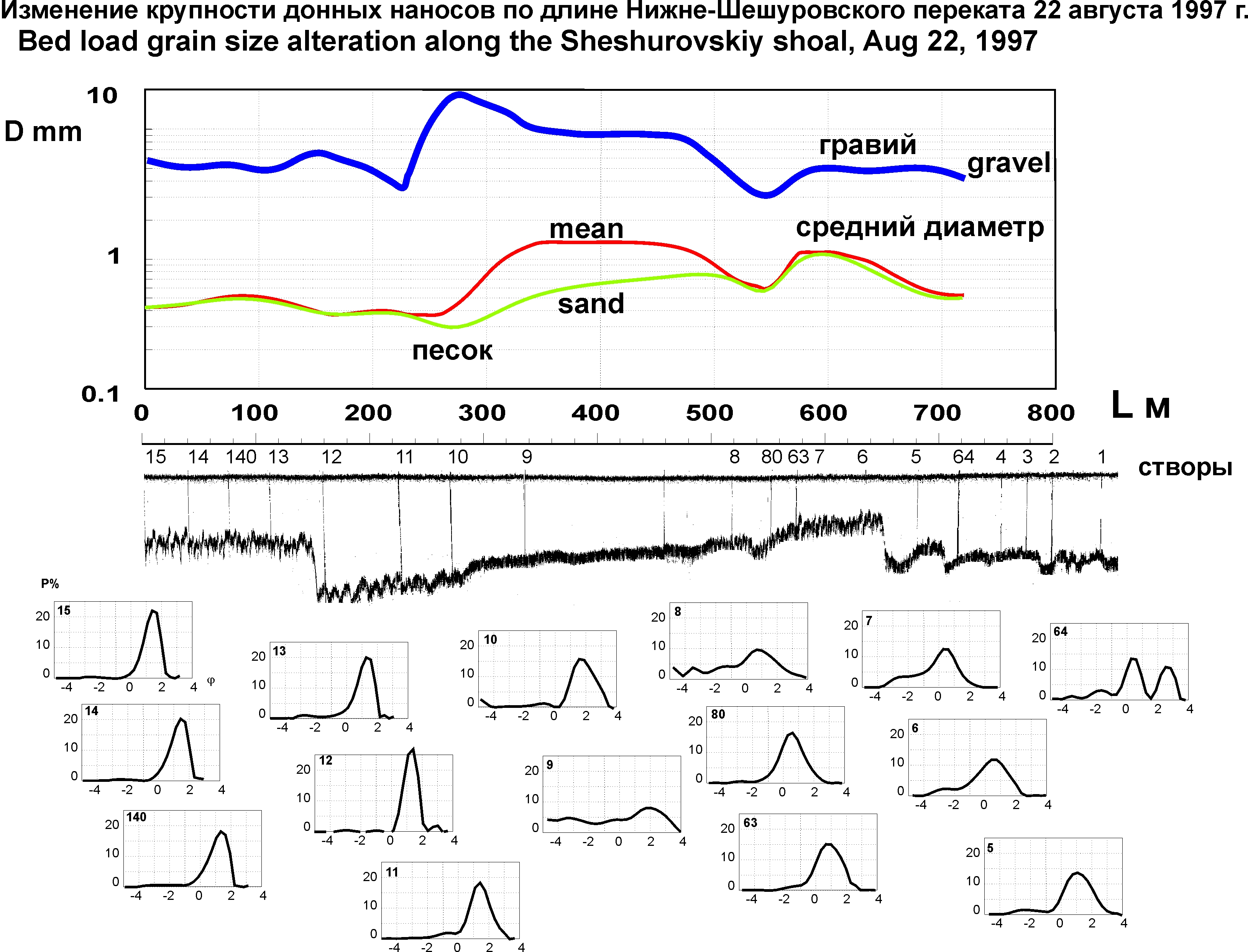
- Bed sediment grain size
distribution at the Sheshurovskiy shoal (table) PDF
- Bed sediment grain size
distribution at the Sheshurovskiy shoal (figure) JPG
- Morphology and dynamics
of the bed-forms on the Sheshurovskiy shoal (table) PDF
- Morphology and dynamics
of the bed-forms on the Sheshurovskiy shoal (figure) JPG
- Morphology and dynamics
of the megaripples on the upper large dune on the Sheshurovskiy shoal 18-31 Aug 1997 TIF
- Morphology and dynamics
of the megaripples on the lower large dune on the Sheshurovskiy shoal TIF
- Morphology and dynamics
of the megaripples on the upper large dune on the Sheshurovskiy shoal 20-21 Aug 1997 TIF
- Morphology and dynamics
of the megaripples on the upper large dune on the Sheshurovskiy shoal 27-28 Aug 1997 TIF
- Sediment transport rate
(m3/s) at
the Sheshurovskiy shoal, the Vychegda River, calculated with morphology and
dynamics of megaripples and large dunes PDF
